October 9, 1846 Pinkweewilenionki
Content Warning: This post discusses specific names of Myaamia people impacted by Removal. It is possible that you may have a personal connection with some of those individuals.
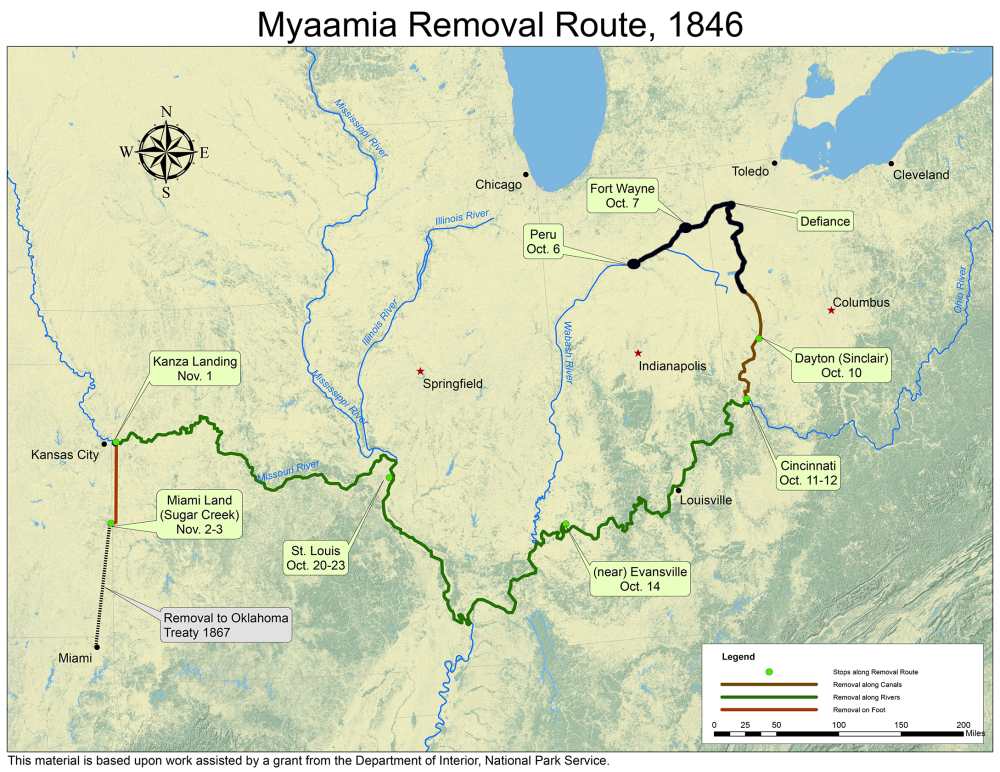
October 9 was the fourth day that Myaamiaki had been on the canal boats, the fifth day for those who had been boarded the day before departure. We can imagine that in addition to fear and sickness, boredom had likely set in. Still, on this day, the canal boats passed Pinkweewilenionki, which was a Myaamia village nearly a century earlier. Certainly, descendants of Myaamiaki who lived at Pinkweewilenionki were now passing by on the canal boats. They would have remembered the story of how this village began, and how it ended. (You can read the history of Pinkweewilenionki, as told by George Ironstrack in his The Crooked Trail to Pickawillany (1747-1752) post.)

Others on the boats were from that area of Ohio, or their parents were. We know that Šiipaakana ‘Thomas Godfroy’ was on one of the canal boats, and that his mother Seekaahkweeta was born in a Myaamia village in what became Ohio. They also may have recognized the Reserve of Waapimaankwa ‘Joseph Richardville’ at the source of the Nameewa Siipiiwi ‘St. Mary’s River,’ as they passed through it. How many recognized these areas as familiar places? The recounting of such memories must have been bittersweet for them.

Map by Kristina Fox with annotations by Diane Hunter from George Strack, et al., myaamiaki aancihsaaciki: A Cultural Exploration of the Myaamia Removal Route (Miami, OK: Miami Tribe of Oklahoma, 2011), which was supported by a National Park Service Historic Preservation Grant (#40-09-NA-4047)
In the next installment, to be posted on October 10, we will continue to follow this story of the Myaamia Forced Removal.
Post written by Diane Hunter, Tribal Historic Preservation Officer for the Miami Tribe of Oklahoma. Diane can be contacted at dhunter@miamination.com.