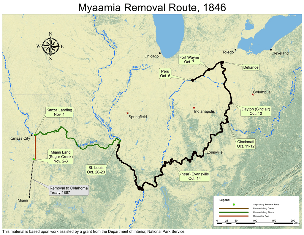
October 22, 1846 Bloody Island
Myaamiaki were still on Bloody Island another day. What were they doing today? Most likely, they were mourning, sitting, and waiting.
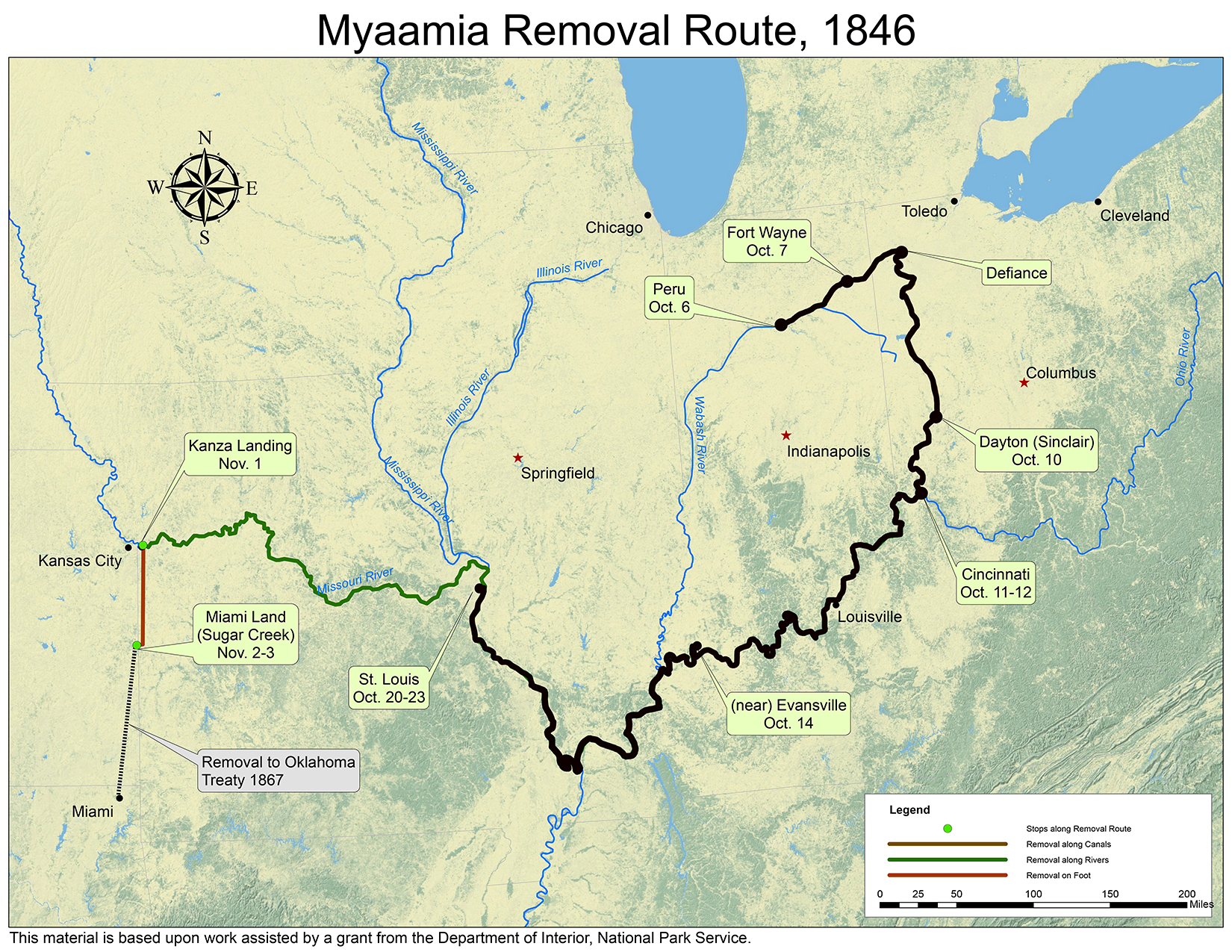
Map by Kristina Fox with annotations by Diane Hunter from George Strack, et al., myaamiaki aancihsaaciki: A Cultural Exploration of the Myaamia Removal Route (Miami, OK: Miami Tribe of Oklahoma, 2011), which was supported by a National Park Service Historic Preservation Grant (#40-09-NA-4047)
In the next installment, to be posted on October 23, we will discover how Myaamiaki are taken from Bloody Island.
Post written by Diane Hunter, Tribal Historic Preservation Officer for the Miami Tribe of Oklahoma. Diane can be contacted at dhunter@miamination.com.

Leave a comment