
In early November of this year, I made a trip to Šikaakonki ‘Chicago’ for a meeting at the Newberry Library about a project called Indigenous Chicago. I was born in Šikaakonki and still have a lot of family living in the city and surrounding suburbs. However, due to COVID, I hadn’t made many trips to the city over the past year and a half.
At the Newberry, I enjoyed meeting and visiting with folks from a variety of tribes all of whom have ongoing connections to Šikaakonki. I also spent time with noohsa ‘my father’ and nisehkosa ‘my aunt’ visiting and sharing meals together. It was great to spend time with some of my favorite people in one of my favorite places. On my way out of the city, I made a stop at a site called Mihsoolatenwi ‘Canoe Hill.’ This unique landscape feature formed as an aašoohkoonatenwi ‘glacier’ melted over 16,000 years ago.
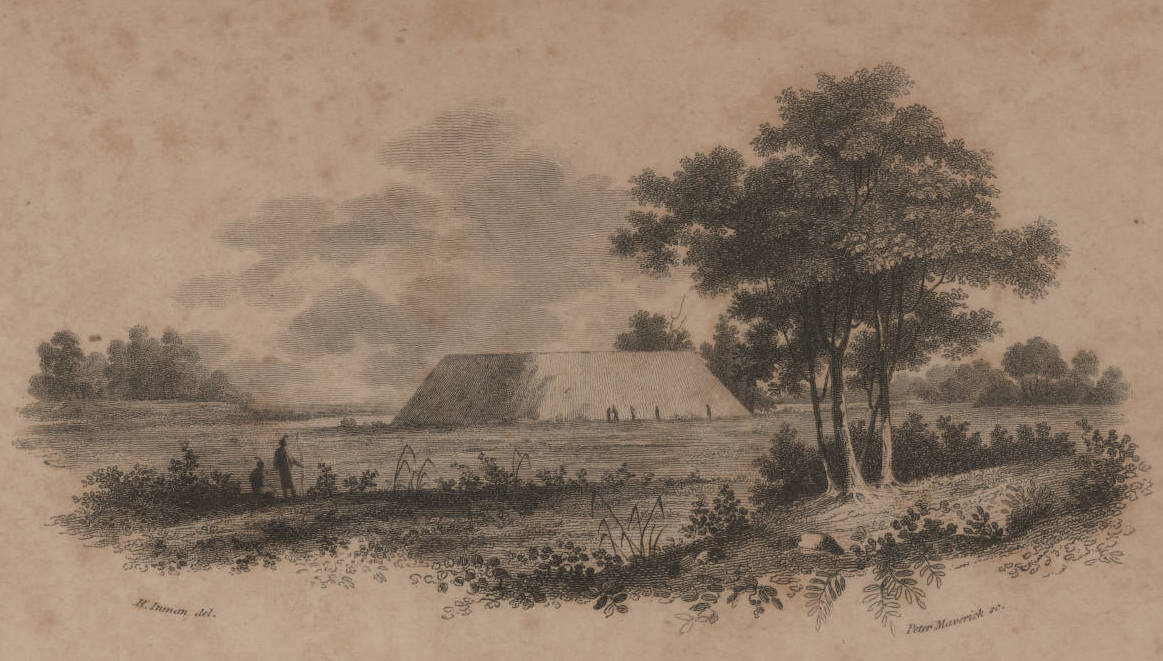
This important place was well-known by my ancestors, but was unfamiliar to me. I learned about the site this spring while re-reading a historical source looking for stories of Myaamionki for our Eewansaapita Summer Youth Program. In the early 1700s, Myaamia and Inohka ‘Illinois’ people shared a story about the site with a visiting Italian, Pierre De Liette. Liette reported that the mound resembled an earthen watercraft and that he was told, “at the time of the deluge, of which it appears they have learned, it was a vessel which had been made to save all mankind from shipwreck; and that, on the subsiding of the waters, being on a bad bottom, it had upset, and in course of time it had changed to earth.”
Unsurprisingly, Liette connected what he was told with the flood story he was most familiar with: the Christian Biblical story of Noah and flood. But the Myaamia and Inohka were likely referring to their own flood story in which our cultural hero Wiihsakacaakwa caused a catastrophic flood that drowned the earth. Depending on the story, Wiihsakacaakwa survived the flood by floating on the surface of the water on the back of a turtle or on a raft. He then worked together with his animal relatives to rebuild the earth using a small amount of soil retrieved from beneath the surface of the water. This likely wasn’t the only place in our homelands connected to Wiihsakacaakwa or our story of the flood, but it was clearly an important one.
In addition to holding the story of the flood, Mihsoolantenwi also served as an important landmark for people traveling by canoe along the Des Plaines river. The Šikaakonki region is notable for its flatness, which was also the result of glaciation. Any small change in elevation in the region stands out dramatically, and historically Mihsoolatenwi loomed over the river valley at sixty feet tall resting on top of an eighty foot bluff. Through a process that is common across our homelands, Mihsoolatenwi was later renamed after a French fur trader. This name was subsequently anglicized as “Mount Joliet.”
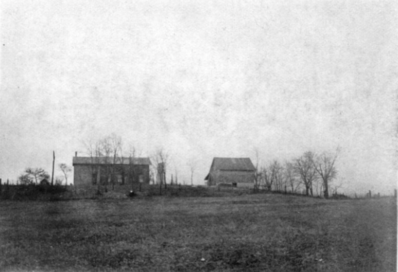
In the mid-1800s, Mihsoolatenwi began to be mined by local settlers for clay and gravel which were used in construction projects in Šikaakonki. Mining continued into the early 1900s when most of the materials deemed useful in construction projects were fully removed. By that point, only small remnants of Mihsoolatenwi remained. In the 1970s, the Will County Historical Society installed a marker near the remains of this once towering hill.

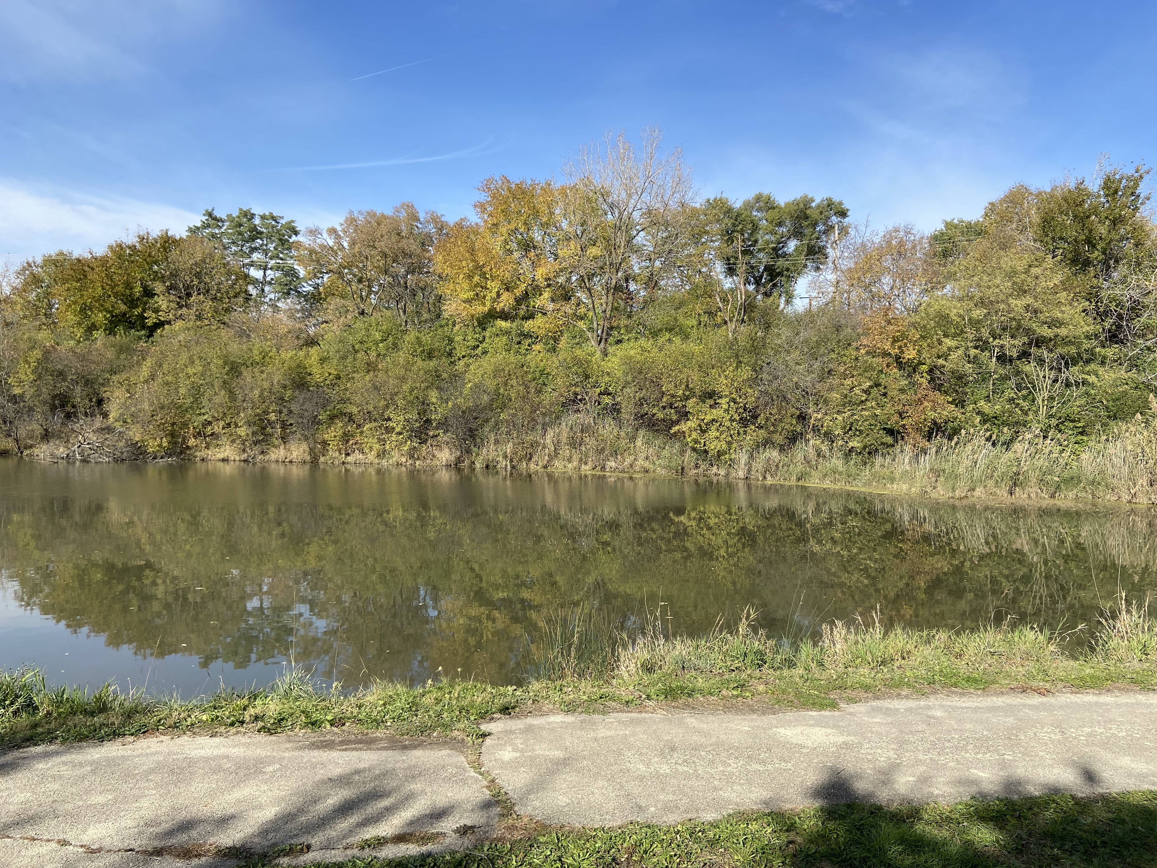
Today, Mihsoolatenwi sits in an industrial area in Rockdale, Illinois near the Illinois and Michigan Canal and the Des Plaines River. Due to brushy overgrowth it is not easy to identify what exactly remains of Mihsoolatenwi, but some of its base appears to remain. On the day I visited, I walked for a bit through the brush and then crossed the canal to look at the site from below. The landscape has been changed radically by hundreds of years of settlement and much of the prominence of Mihsoolatenwi was not as obvious on that day as it had been to my ancestors. Still, it felt good to stand in that place and sound out the name of the place in our language. It felt good to think about how my ancestors connected with this place through travel and story and how we can reconnect to Mihsoolatenwi by visiting and telling all the stories connected to it.
We still have a lot to learn about Mihsoolatenwi in order to best reconnect with it as a community. I’m confident that this winter we’ll be sharing stories connected to this place, and as COVID neehseehpineenki recedes we’ll be ready as a community to make our next visits to the site.
Notes
[1] Henry Rowe Schoolcraft, Travels in the Central Portions of the Mississippi Valley: Comprising Observations on Its Mineral Geography, Internal Resources, and Aboriginal Population : Performed under the Sanction of Government, in the Year 1821 (New-York : Collins and Hannay, 1825), 330-32.
[2] Pierre de Liette, “Memoir concerning the Illinois Country, ca. 1693,” in Collections of the Illinois State Historical Library, vol. XXIII: The French Foundations, ed. Theodore Calvin Pease and Raymond C. Werner (Springfield, 1934), 303-04.
[3] Robert Knight, M. W. S. E., and Lucius Zeuch. 1930. “Mount Joliet: Its Place in Illinois History and Its Location.” Journal of the Illinois State Historical Society (1908-1984) 23 (1): 84–91.

Leave a comment