
November 3, 1846 The Overland Journey
Content Warning: This post discusses the death of Myaamiaki.
Myaamiaki continued their journey by horse and wagon toward their new reservation. Today a 16-year-old boy died, bringing the total deaths on this Removal journal to seven.
As Myaamiaki traveled south on the military road, they passed the reservations of the Shawnee and the Waayaahtanooki ‘Wea’ and Peeyankihšia ‘Piankeshaw,’ tribes who had previously been their relatives and neighbors in Indiana. Today the military road is U.S. 69 in eastern Kansas.
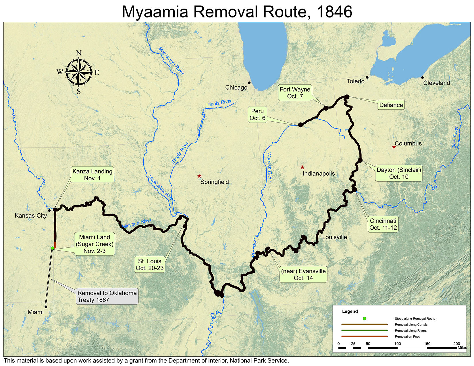
Map by Kristina Fox with annotations by Diane Hunter from George Strack, et al., myaamiaki aancihsaaciki: A Cultural Exploration of the Myaamia Removal Route (Miami, OK: Miami Tribe of Oklahoma, 2011), which was supported by a National Park Service Historic Preservation Grant (#40-09-NA-4047)
In the next installment, to be posted on November 4, we begin to see the end of the journey.
Post written by Diane Hunter, Tribal Historic Preservation Officer for the Miami Tribe of Oklahoma. Diane can be contacted at dhunter@miamination.com.

Leave a comment