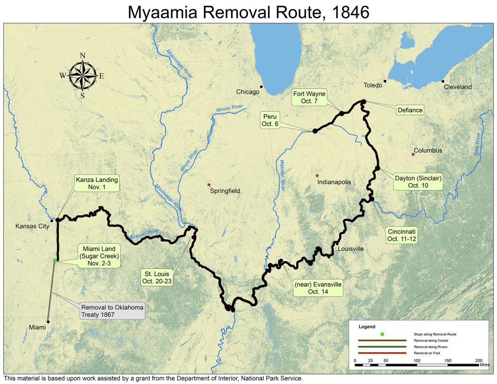
November 4, 1846 Sugar Creek
Today some Myaamiaki completed the 50-mile journey from the Town of Kansas to the Miami Reservation on Sugar Creek in the Osage River Sub-Agency, one mile west of the military road they had traveled.
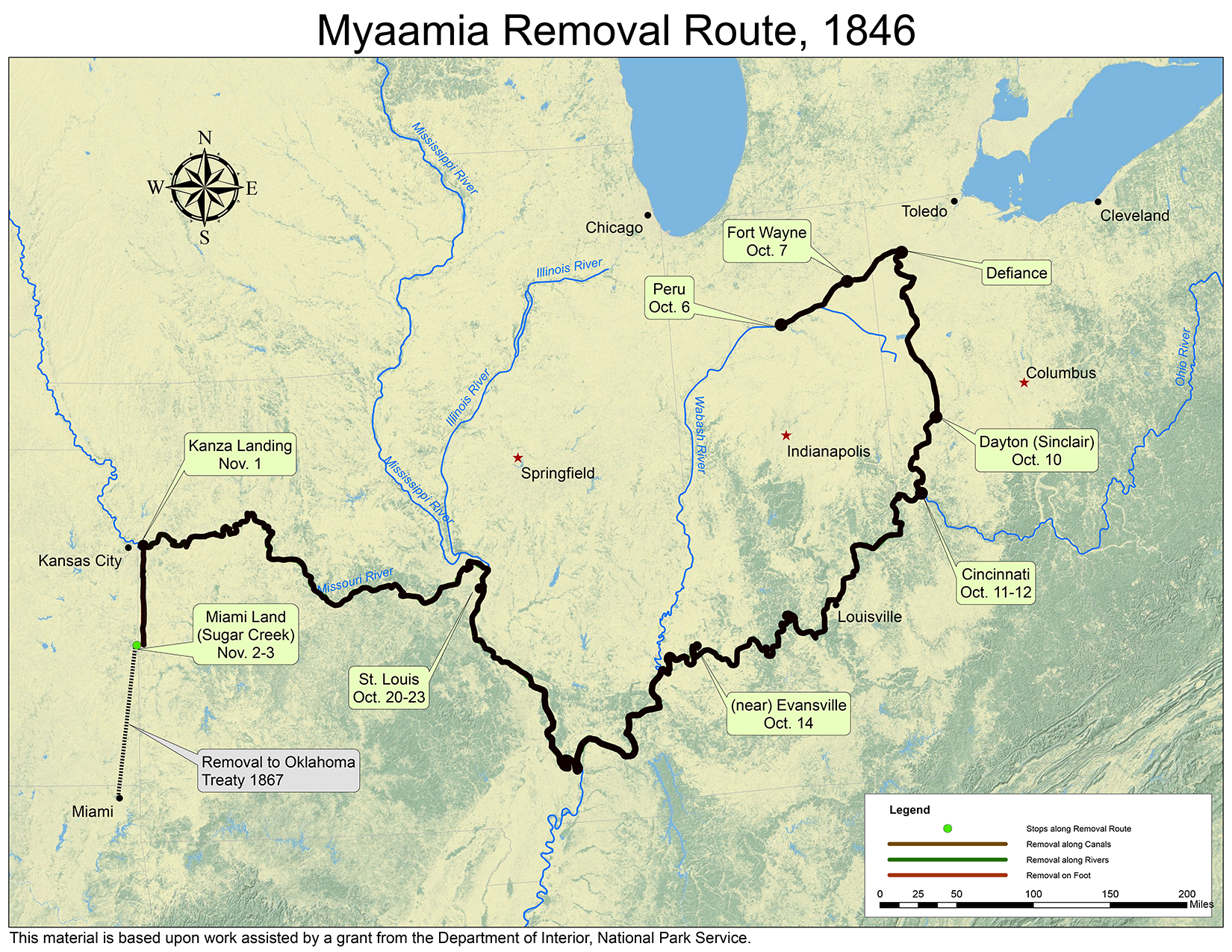
Map by Kristina Fox with annotations by Diane Hunter from George Strack, et al., myaamiaki aancihsaaciki: A Cultural Exploration of the Myaamia Removal Route (Miami, OK: Miami Tribe of Oklahoma, 2011), which was supported by a National Park Service Historic Preservation Grant (#40-09-NA-4047)
In the next installment, to be posted on November 5, we will see what these Myaamiaki and those who arrived the next day experienced when they arrived at the Miami Reservation.
Post written by Diane Hunter, Tribal Historic Preservation Officer for the Miami Tribe of Oklahoma. Diane can be contacted at dhunter@miamination.com.

Leave a comment