October 20, 1846 Bloody Island
Content Warning: This post discusses the death of a child and an adult.
Two days after the death of the infant from Waawiyaasita’s band, a Myaamia elder, a man named Ottawa, also died.
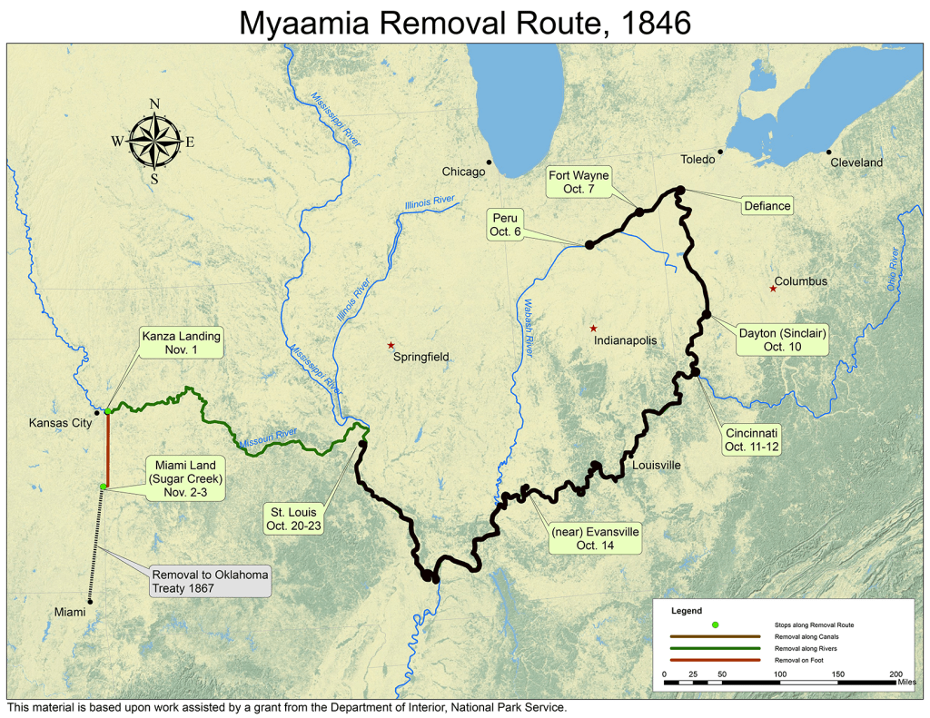
Later that same day, the steamboat Colorado arrived outside of St. Louis. Myaamiaki deboarded at a place called Bloody Island, a sandbar on the Illinois side of the Mihsi-Siipiiwi ‘Mississippi River.’ It was so named because, being located in the Mississippi River and legally not considered part of either Illinois or Missouri, it was a common place to hold duels, which were otherwise illegal.
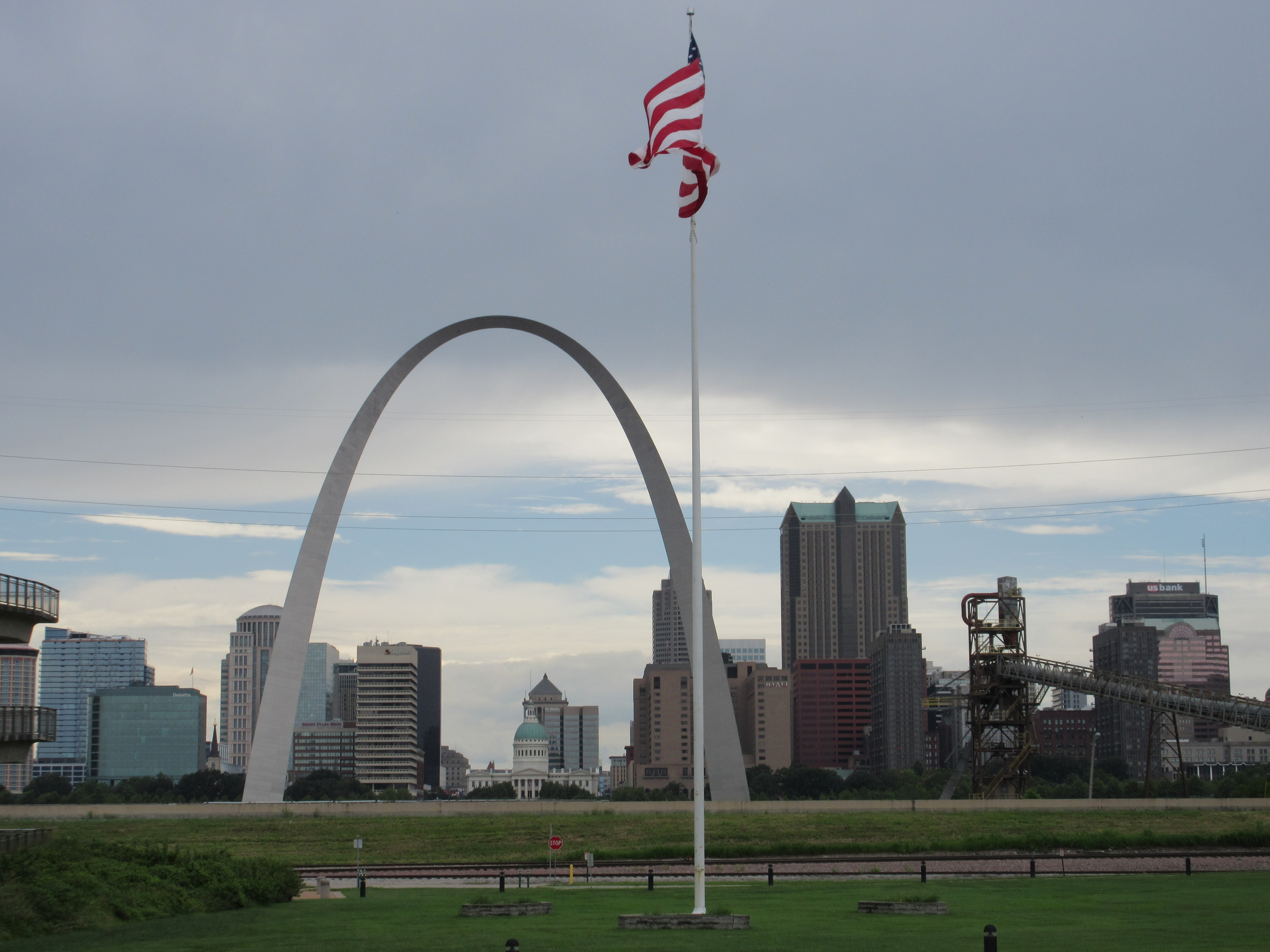
Bloody Island is an apt name for the place where they buried Ottawa and the Waawiyaasita piloohsa, “performing their peculiar funeral ceremony.” This quote from Removal Agent Joseph Sinclair most certainly refers to burial rites that included the peekomaata, words said to aid the deceased in entering the afterlife. Today Bloody Island is part of the Mississippi riverbank on the Illinois side. It is directly across the river from the St. Louis Arch, the Gateway to the West.
Toohpia ‘Francis LaFontaine,’ his wife, and his children were exempted from Removal; however, as Principal Chief, he accompanied his people on this Removal journey and brought his family with him. In an October 21 letter, he wrote, “Little Joseph my son has been sick but is getting Better.” We can imagine the concern of these parents carrying for their sick four-year-old child, while witnessing the burial of another child who perhaps died of the same sickness. We must wonder if he regretted bringing his young children.
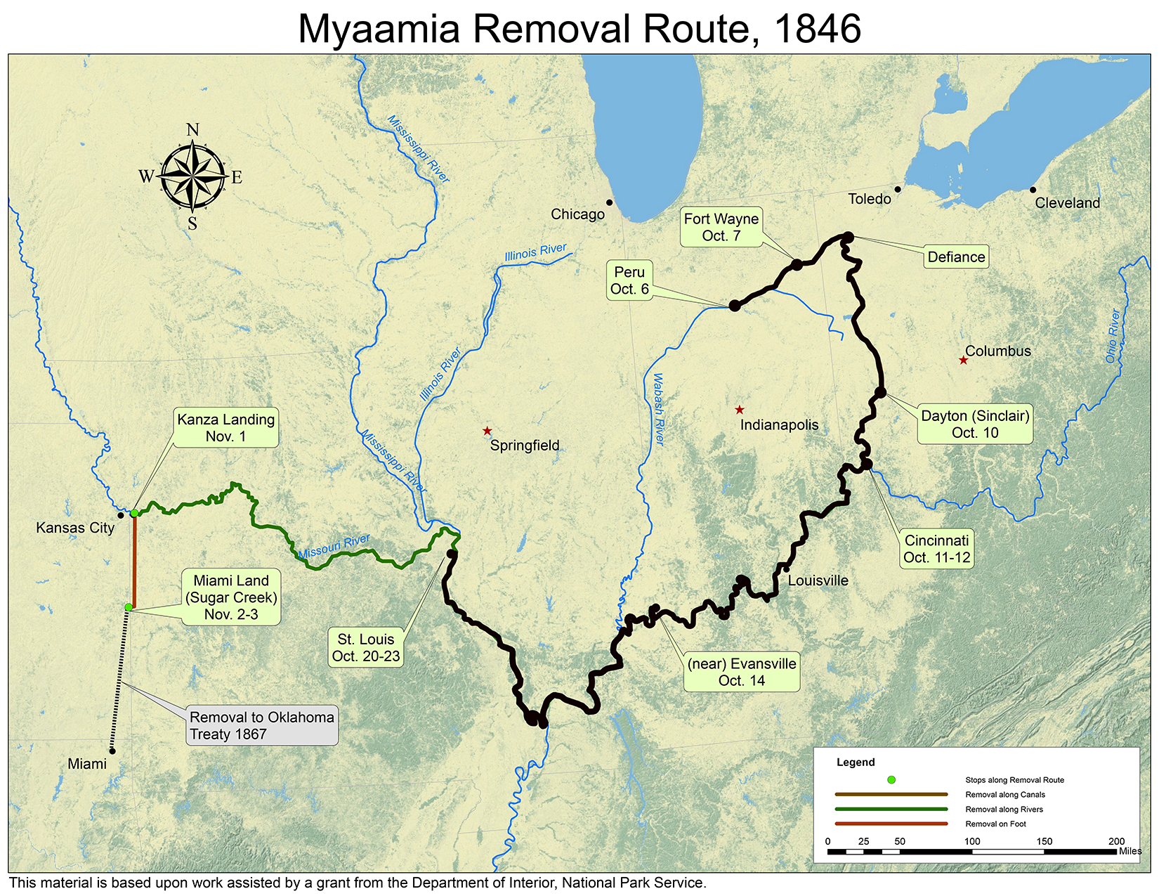
Map by Kristina Fox with annotations by Diane Hunter from George Strack, et al., myaamiaki aancihsaaciki: A Cultural Exploration of the Myaamia Removal Route (Miami, OK: Miami Tribe of Oklahoma, 2011), which was supported by a National Park Service Historic Preservation Grant (#40-09-NA-4047)
In the next installment, to be posted on October 21, we find that Myaamiaki are still on Bloody Island.
Post written by Diane Hunter, Tribal Historic Preservation Officer for the Miami Tribe of Oklahoma. Diane can be contacted at dhunter@miamination.com.

Leave a comment